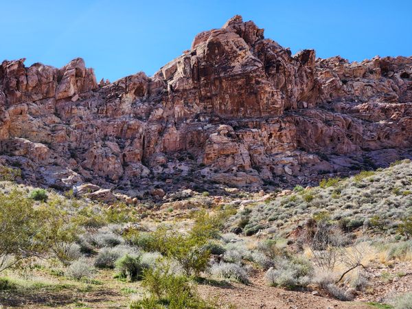
The Muddy Mountains of southern Nevada, between Lake Mead and Interstate 15, consist largely of dark limestone thrust over younger rocks, the colorful Aztec (Navajo) Sandstone of Jurassic age, on a low-angle fault. In Valley of Fire State Park, the overlying limestones have been eroded to reveal the underlying Aztec, itself eroded into spectacular and colorful landforms.
Valley of Fire, however, is not the only place like this. Some eight miles to the west-southwest the limestones have also been eroded to reveal the underlying sandstone. This area, centered on Buffington Pockets, is traversed by the Bitter Springs Back Country Byway. (A pocket is a shallow erosional basin in the sandstone that can hold rainwater. Also called tinajas, from the Spanish for “jar,” such basins were of great importance both for wildlife and for human travelers.)
About a mile beyond where the Bitter Springs Back Country Byway first enters a rough canyon, an incongruous concrete dam, presumably for water storage, occurs a few hundred yards off the road to the left. There are lots of places to park along here. The dam presumably dates to the early 20th century. In more recent years, a large picture of an owl in flight has been painted on its downstream face. The canyon above the dam includes petroglyphs. Petroglyphs are irreplaceable; please don’t touch or trace them; take photographs only.
Besides many attractive red sandstone outcrops and bluffs, there are even some arches in the area.
One of the most interesting areas is Colorock Quarry, where there was an attempt to quarry red sandstone for decorative stone, probably in the late 1920s. It includes the ruins of a stone cabin, as well as some drilled and partly finished blocks, and some obvious debris from the rock cutting. However, the absence of extensive spoil deposits from the quarry indicates the operation must have been very short-lived. Transportation costs would have been high, even though gasoline-powered trucks would have been available by then, and in any case, the arrival of the Great Depression would have eliminated potential markets. Colorock Quarry is reached by a road branching off the Bitter Springs Byway.
Know Before You Go
Despite its grandiose name, the Bitter Springs Back-Country Byway is a primitive road that requires high clearance through much of its length and even 4wd in spots. A passenger car might be able to reach the edge of the Pockets from the west side, but will not be able to go any farther. Of course, the difficult access is the major reason Buffington Pockets get much less usage than Valley of Fire.
To reach the Bitter Springs Back-Country Byway, take the Valley of Fire highway (Nevada State Route 169) 3.1 miles from its junction with Interstate 15 (Exit 75) to an intersection (at about 36.46101 N, 114.73602 W). Here the paved road bends to the left, while a dirt road keeps going straight. Keep going straight; this is the Bitter Springs Back-Country Byway. After about 5 miles, the road drops into a drainage and enters a canyon, where it gets much rougher. The concrete dam mentioned above is about another mile.
You can follow the Bitter Springs Back-Country Byway all the way to North Shore Road (Nevada State Route 167) by Lake Mead, but this involves about 15 miles of very rough road requiring high clearance at a minimum.
To get to Colorock Quarry, turn right off the Bitter Springs Back-Country Byway onto a primitive road at an intersection some 4.3 miles after leaving State Route 169 (at about 36.40635 N, 114.70831 W). Bear right in 0.2 miles and go 2.6 miles where the road tops out over a ridge. There are some side roads here, but to get to the Colorock Quarry keep going east 0.8 miles down the canyon ahead. Four-wheel drive is likely to be necessary on parts of the Colorock Quarry road.
The Muddy Mountains Wilderness area begins just beyond the Colorock site; please don’t enter it with a motor vehicle, but non-motorized travel is encouraged.

