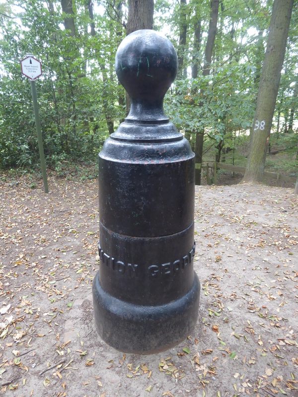
From far away, this cast iron statue looks eerily like the silhouette of a man. Upon closer inspection, the inscription on its side gives away its true purpose:”Borne géodésique,” meaning geodesic terminal.
In 1863, the military engineers were given the task of mapping Belgium. Triangulations were made from high monuments. In areas that had no visual landmarks, geodetic stations were added. A total of 86 were gradually installed. The Iron Man of Braine-le-Comte was put in place in 1890. To make it more visible in the landscape, it was initially topped by a 98-foot-high wooden structure. This structure was equipped with a concealed pulley that made it possible to lift the upper part of the Iron Man. This allowed access to the base of the geodetic marker: A perfectly horizontal surface whose height is known with precision. The last measurements were taken from the top of the marker in 1953.